

Introduction
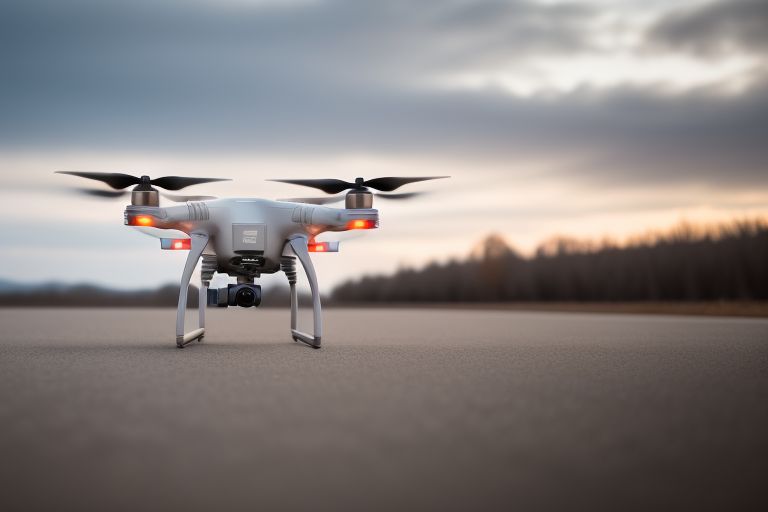
In today’s fast changing technology landscape, drones have emerged as potent instruments for altering a variety of businesses. The surveying and mapping sectors, in particular, have undergone a tremendous transformation as a result of the introduction of drone services.
Drones, with their ability to collect high-resolution imagery from previously unreachable vantage points, are changing the way we view and interact with our surroundings.
Let’s dive into the exciting realm of drone-assisted surveying and mapping, and see how unmanned aerial vehicles (UAVs) are mapping the future.
The Rise of Drone Services
Traditional surveying and mapping technologies frequently required time-consuming procedures, expensive expenses, and safety concerns. Enter drone services, which provide a game-changing option.
Drones, which are equipped with modern sensors and cameras, can acquire aerial data quickly and with remarkable precision and detail. This skill has created a multitude of opportunities in a variety of industries, including construction, agriculture, urban planning, and environmental monitoring.
Precision mapping at your fingertips
One of the most significant benefits of drone services in surveying and mapping is their capacity to give very accurate and current spatial data.
Drones may capture imagery and collect data points at centimeter-level accuracy by flying over selected areas.
This degree of precision allows experts to produce comprehensive maps, 3D models, and topographic surveys more quickly and efficiently than ever before.
Unlocking inaccessible terrain
Traditional surveying methods frequently encountered difficulties when it comes to accessing isolated or hazardous terrain.
These barriers are no longer an impediment for drones. Whether it’s rough mountains, dense forests, or huge landscapes, drones can easily traverse and collect data from regions that were previously inaccessible or dangerous for human surveyors.
This increased accessibility opens the door to a variety of applications, including land management, resource discovery, and environmental conservation.
Streamlining construction projects
In the construction sector, time is money and accuracy is essential. Drone services provide significant insights to construction professionals throughout the project lifecycle.
Drones deliver real-time data that allows for better decision-making and increases project efficiency, from initial site surveys and progress monitoring to as-built documentation.
Construction organizations may reduce errors, optimize resource allocation, and improve overall project management by taking aerial photos on a regular basis and creating precise 3D models.
Agricultural Advancements From Above
Agriculture is another area that would greatly benefit from the integration of drone services. Farmers can use aerial data gathered by drones to make data-driven decisions to improve agricultural yields, monitor plant health, and manage resources more effectively.
Drones equipped with specific sensors provide crucial insights that assist farmers increase output while minimizing environmental effect, ranging from analyzing soil moisture levels to recognizing crop stress and pest infestation.
Embracing Environmental Conservation
In the domain of environmental protection, drones are proving to be important companions. Conservationists can use drones to monitor wildlife numbers, track environmental changes, and prevent illicit activities like poaching and deforestation.
Drones’ capacity to cover broad regions swiftly and quietly makes conservation initiatives more proactive, data-driven, and cost-effective, ultimately helping to the preservation of our planet’s biodiversity.
The Future of Surveying and Mapping
As drone technology advances, the opportunities for surveying and mapping grow exponentially. Advancements in AI-powered data analysis, as well as the integration of LiDAR and hyperspectral imaging technologies, offer even better precision, efficiency, and versatility in aerial data collection.
As drone services become more available and affordable, we may expect widespread use across industries, fostering innovation and transforming our perception of the world around us.
Overcoming Challenges and Ensuring Safety
While the advantages of drone services in surveying and mapping are clear, it is critical to address specific issues and considerations. Privacy problems, regulatory compliance, and safety threats are among the important factors that require careful consideration.
As drones grow more common, operators must follow local legislation, obtain required permits, and prioritize safety practices to ensure responsible and ethical use of this technology.
Providing Professionals with Training and Education
As the demand for drone services increases, so does the need for skilled experts who can fully utilize this technology. Investing in training and education programs for drone operators, surveyors, and mapping experts is critical to ensuring competency, competence, and industry compliance.
By providing individuals with the information and skills needed to operate drones safely and effectively, we can build an environment of creativity and excellence in aerial surveying and mapping.
Collaboration and Integration for Maximum Impact
To fully realize the benefits of drone services in surveying and mapping, coordination and integration with other technologies are essential. Integrating drone data with current systems allows for smooth workflows and improves data analysis capabilities.
By breaking down barriers and promoting interoperability, we may get fresh insights and encourage more innovation in geographic data management and analysis.
You can read Drone Inspection Redefining Quality Assurance in Industry
Embracing Sustainability and Ethical Considerations
As we use drone services for surveying and mapping, it is critical to focus ecological and ethical concerns. Drone technology’s long-term sustainability and adoption depend on minimizing environmental effect, preserving privacy rights, and supporting appropriate data management methods.
By adhering to ethical standards and implementing sustainable methods, we can ensure that the benefits of drone-assisted surveying and mapping are achieved in a courteous, egalitarian, and environmentally responsible manner.
You can read Elevating Construction Safety Through 3D Laser Scanning Survey Services
Looking ahead: the evolution of drone services
As we look ahead, the evolution of drone services for surveying and mapping shows no indications of slowing. The possibilities are endless as drone technology, sensor capabilities, and data analytics continue to evolve.
From smart cities and infrastructure development to disaster response and environmental monitoring, drones will continue to shape how we interact with and comprehend our planet.
Conclusion
To summarize, drone services are creating a paradigm shift in the surveying and mapping industries, providing unparalleled levels of precision, accessibility, and efficiency. By embracing this disruptive technology and solving its limitations, we may create new opportunities for creativity, collaboration, and sustainable development. As we sketch the future from above, let us do it with a sense of duty, integrity, and stewardship for our planet’s resources.
You Can Read More Informative Blogs On Digiesales.com


